What This Route Guide Covers
The run from Dania Beach up to Fort Lauderdale is one of the most rewarding personal watercraft (PWC) trips in South Florida. In roughly eight miles you pass state park mangroves, a working deep-water seaport, mega-yacht rows, and the marinas of Las Olas. It is also a route that punishes riders who show up unprepared, because it threads a busy commercial channel and a string of bridges shared with everything from paddleboards to cargo ships.
This guide walks you through the whole trip the way an experienced Florida operator would plan it: choosing between the Intracoastal Waterway and the open ocean, building a realistic fuel and weather plan, crossing Port Everglades without becoming a statistic, reading the bridges and manatee zones, timing your departure around tides and traffic, and knowing exactly what Florida law requires before you ever untie the line. By the end you will be able to draw your own float plan and ride it with confidence.
Every recommendation here is built on standard Florida boating rules and the same navigation fundamentals taught in a state-standards online Florida boating safety course. If you are still shopping for your education card, read to the end for how to get certified before your first trip.
Choosing Your Route: ICW or Open Ocean
You have two realistic ways to get from Dania Beach to Fort Lauderdale, and for the vast majority of riders only one of them makes sense.
The Intracoastal Waterway (recommended)
The Intracoastal Waterway (ICW) runs north through protected water, sheltered from ocean swell by the barrier island. It is marked, patrolled, and dotted with marinas where you can fuel, rest, or shelter if weather turns. The channel carries plenty of depth for a PWC, and the marked edges keep you off the shallow grass flats where you can run aground or damage seagrass.
The trade-off is traffic and rules. The ICW is a no-nonsense navigation corridor with idle-speed and no-wake zones, manatee protection areas, and heavy weekend congestion. You will share it with yacht tenders, dive boats, rental fleets, and the occasional barge. That is exactly why the skills from a formal course matter here. If you are new to this stretch, review the Fort Lauderdale Intracoastal Waterway boating rules before you go, because enforcement along this corridor is active.
The open-ocean route (advanced only)
Running "outside" in the Atlantic is shorter in a straight line but exposes you to swell, wind chop, and long stretches with no easy landing. There are no fuel stops offshore, sea conditions can change within an hour, and a mechanical failure leaves you far fewer options. Unless you are an experienced ocean rider on a well-maintained ski with offshore-grade safety gear, plan on the ICW. Beginners in particular should stay inside; the same logic applies anywhere in Florida, as the comparison in Pensacola Pass vs. open Gulf spells out.
Pre-Trip Planning Essentials
A good trip is decided at the dock, not on the water. Build your plan around three questions: Is the weather safe? Do I have enough fuel and reserve? Does someone ashore know where I am?
Read the weather like a boater
Check a marine forecast, not just a phone weather app. The National Oceanic and Atmospheric Administration (NOAA) marine forecast gives you wind speed and direction, wave heights, and any small craft advisory in force. In summer, South Florida's afternoon thunderstorms build fast and produce dangerous lightning and sudden wind. The safest rule for this route in the wet season is simple: ride in the morning and be off the water by early afternoon.
Cancel or postpone if you see a small craft advisory, thunderstorms in the forecast window, sustained winds that will turn the open sections into a washing machine, or reduced visibility. On a PWC you have no cabin and no shelter, so "when in doubt, don't go" is not caution, it is competence.
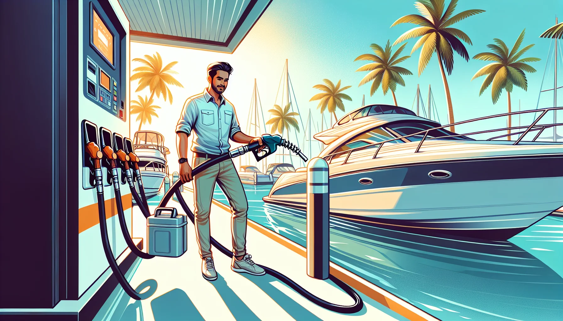
Plan fuel with a real reserve
PWC fuel burn varies widely with throttle, load, and chop, so plan conservatively. A common planning habit is the "rule of thirds": one third of your fuel out, one third back, and one third held in reserve. Top off in Dania Beach before you launch, because dockside fuel gets more expensive as you move into the Fort Lauderdale marinas. If you plan to fuel mid-trip, do it calmly and correctly. Fueling is one of the most common causes of on-water fires, so follow the same discipline described in this guide to safe fueling procedures at Dania Beach marinas: engine off, no smoking, ventilate before restart, and wipe up spills.
File a float plan
Tell a reliable person where you are going, your intended route, who is with you, a description of your ski, and when you expect to be back. A float plan is the single cheapest piece of safety equipment you own, and it is what turns a missed check-in into a fast, targeted search instead of a guessing game.
Carry the right gear
Florida law requires a wearable life jacket (PFD) for each person aboard, and on a PWC every rider must actually wear it, not stow it. You also need a sound-producing device such as a whistle, and your engine cut-off switch lanyard must be attached to you, your clothing, or your PFD so the engine stops if you fall off. Beyond the legal minimum, bring a phone in a waterproof case, and consider a handheld VHF radio for the Port Everglades stretch where monitoring traffic matters. For a full breakdown of what counts as legal, see the Florida life jacket and PFD requirements guide.
Navigating Port Everglades Safely
If there is one section of this trip that demands your full attention, it is the Port Everglades crossing, roughly a third of the way up. This is a deep-draft commercial seaport handling cruise ships, cargo vessels, fuel tankers, and Navy traffic. The stakes here are not about tickets; they are about survival.
Why it is dangerous
Large ships cannot stop or turn quickly, have enormous blind spots, and generate powerful prop wash and currents. Under the navigation rules, a small, highly maneuverable PWC is the "give-way" vessel around a large vessel constrained by its draft. In plain terms: the ship has the right of way, it cannot dodge you, and you must stay out of its path. There are also federally enforced security zones around cruise and certain commercial vessels that you must never enter.
How to cross
- Stop short of the channel and look both ways along the full length of the waterway before committing.
- Monitor VHF channel 16 if you carry a radio, and watch for movement at the inlet and around the ship berths.
- Never start across if a large vessel is approaching or maneuvering. Wait. A few minutes of patience is free.
- When the channel is clear, cross the shortest way, roughly perpendicular, at a steady, purposeful speed, and do not stop or loiter in the ship channel.
- Give commercial vessels a wide berth. If a ship is moving, treat the entire channel as off-limits until it has passed and its wake has settled.
Understanding right-of-way is what keeps you alive here, and it is exactly the kind of decision-making covered in a proper boat navigation rules and right-of-way course lesson. Cross Port Everglades like a professional and the rest of the trip is comparatively easy.
Bridges, Manatee Zones, and No-Wake Rules
North of the port, the character of the ride changes to yacht-lined channels, marina entrances, and a series of bridges. Speed discipline becomes the whole game.
Reading the bridges
Some bridges are fixed and high enough that a PWC simply passes underneath with room to spare, so vertical clearance is rarely your concern on a jet ski. What matters is the traffic funneling through them and the current that accelerates in the narrow spans. Slow down on the approach, pass through the center of the navigable span, stay to the correct side, and never cut in front of a larger vessel that is lining up for the opening. If a drawbridge is opening for tall traffic, hold back and let the queue sort itself out rather than squeezing through.
Respect the manatee zones
South Florida's ICW runs through designated manatee protection areas where idle-speed or slow-speed limits apply, some year-round and some seasonal (typically cooler months when manatees congregate). These zones are marked with signs, and marine officers enforce them strictly because a PWC strike can kill a manatee. Drop to idle where posted, keep a lookout in the shallow, grassy edges where manatees feed, and never chase or crowd one. The details of how these areas work are in the Florida manatee zones and speed regulations guide, and they are worth knowing before you launch.
No-wake etiquette
Idle-speed and no-wake zones apply near marinas, moored boats, docks, and congested areas. Your wake is your responsibility: it can damage docked vessels, swamp a kayak, or throw someone off a paddleboard. In the mega-yacht corridors around Fort Lauderdale, wake control is not optional, and the courtesy of passing slowly earns you goodwill and keeps you out of a wake-damage claim. The specific technique for sharing water with the biggest vessels is covered in passing mega yachts safely.
Timing Your Trip: Tides, Traffic, and Seasons
When you leave the dock affects almost everything about the ride.
Tides and current
The ICW current shifts with the tide, and it runs fastest through the narrow bridge spans and near inlets. Riding with the current is faster and burns less fuel; riding against it costs you time and gas. Slack tide, the brief window around high or low, gives the calmest, most predictable handling, which is helpful at the Port Everglades crossing and the busier bridges. Check a tide table for the day and plan your departure so the trickiest sections line up with easier water.
Traffic
Weekend afternoons, holidays, and special events pack this corridor. Boat show season and spring break add rental fleets and inexperienced operators to the mix. If you can, ride on a weekday morning: less traffic, calmer water, and easier crossings. The difference between a 9 a.m. weekday and a 2 p.m. Saturday on this route is night and day.
Seasons and daylight
Winter brings cooler, often clearer conditions and the peak manatee season, so expect more idle zones enforced. Summer means warm water but daily afternoon storms, which is why morning-only riding is the norm. Whatever the season, remember the daylight rule that governs PWC operation in Florida: a personal watercraft may not be operated from a half-hour after sunset to a half-hour before sunrise. This is a strictly day-only trip, so plan your return with a comfortable margin before dusk. Reading local water is a skill in itself; the approach in reading tides for Madeira Beach boating transfers directly to planning this run.
Emergency Preparedness on the Water
Even a well-planned trip can throw a mechanical problem, a sudden squall, or a rider going overboard. What separates a scare from a disaster is having a plan before you need one.
If your ski breaks down
Stay with the vessel. A floating PWC is far easier to spot than a person in the water, and it keeps you buoyant. Signal for help, call for assistance by phone or VHF channel 16, and if you are drifting toward a hazard or the channel, try to get clear of traffic. Know your towing options before you launch. Nationwide the U.S. Coast Guard monitors VHF 16 and 911 works from a cell phone; for a full step-by-step, the jet ski breakdown playbook applies anywhere in Florida.
If weather turns
Do not try to outrun a building thunderstorm across open water. Head for the nearest protected marina or sheltered basin, get off the water, and wait it out. Lightning is the real killer, and there is no safe place on an open PWC. Identify your bail-out points during planning so you already know where to run.
Know when it is legally an "accident"
Florida requires you to report a boating accident to the authorities in serious cases: a death or a person disappearing under circumstances suggesting death or injury, an injury requiring more than basic first aid, or significant property damage (the threshold is $2,000 or more). Stop, render aid, exchange information, and report. Knowing this in advance keeps you from making a costly mistake in a stressful moment.
Legal Requirements Before You Launch
Before any of the route planning matters, make sure you are legal to operate.
Education card
Under Florida law, anyone born on or after January 1, 1988 must complete an approved boating safety course and carry a Boating Safety Education Identification Card to operate a vessel powered by 10 horsepower or more. A PWC qualifies, so most adult riders on this route need the card. The course is taken once and the card does not expire, so it is a one-time step that clears you for life.
PWC age and operation rules
Florida sets a minimum age of 14 to operate a personal watercraft, and it is illegal to lease or rent a PWC to anyone under 18. Alcohol is treated as seriously on the water as on the road: boating under the influence (BUI) starts at a 0.08 blood-alcohol level, and 0.02 for operators under 21. The Port Everglades crossing alone is reason enough to ride sober. If you want the full picture of who can ride and when, the Florida jet ski and PWC laws guide lays it out.
The course and exam
An state-standards online course is the fastest path to your card. You study at your own pace, then take a final exam of 25 questions requiring 80% to pass, with unlimited retakes if you need them. Most riders finish in a single sitting and can present proof of completion right away. It is inexpensive, it is required, and it teaches the exact right-of-way, navigation, and emergency skills this Dania Beach to Fort Lauderdale route demands.
Start the state-standards online course - $12.99
Final Pre-Departure Checklist
Run through this before you leave the dock and you will have covered the essentials of a safe trip:
- Weather checked on a marine forecast, with a clear morning window and no advisories.
- Fuel topped off in Dania Beach with a real reserve held back.
- Float plan filed with someone ashore, including your route and return time.
- PFDs worn by everyone, whistle aboard, engine cut-off lanyard attached.
- Phone in a waterproof case, VHF if you carry one, tow contacts saved.
- Education card on you, plus registration and required safety gear.
- Tide and traffic timed so Port Everglades and the bridges fall on easy water.
- Bail-out points identified in case weather or a breakdown forces a stop.
The Dania Beach to Fort Lauderdale ICW run is genuinely one of the best day trips a PWC rider can make in Florida. It rewards preparation and punishes shortcuts. Plan your weather, respect Port Everglades, mind the manatee and no-wake zones, ride sober and in daylight, and keep a reserve of both fuel and patience, and you will arrive at Las Olas relaxed instead of rattled.
The foundation for all of it is a solid boating education. If you have not earned your Florida card yet, do it before your next trip, and treat the course as the first leg of this route rather than a box to check.