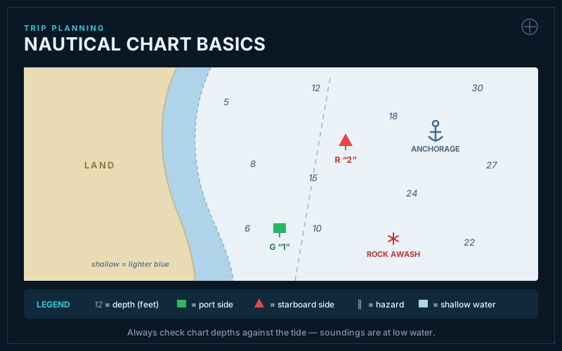
Nautical Chart Basics
Navigation tools help you determine your position and plot safe routes. Electronic and traditional tools complement each other.
GPS (Global Positioning System) provides accurate position information. Most smartphones and dedicated marine GPS units work well.
6 more sections, 1 more key terms, plus chapter quizzes and the 25-question final exam — with unlimited retakes.
Unlock the Full CourseKey Terms Preview
GPS
Global Positioning System for determining location
Nautical Chart
Map showing water depths and navigation information
+ 1 more key terms in the full lesson
More in Trip Planning & Preparation