Cape Coral holds more miles of navigable canals than any other city on Earth - a web of waterways so vast it dwarfs Venice, Italy. For a jet ski rider, that is either the ultimate playground or a fast way to end up stranded at a dead end, aground on a shoal, or ticketed by Cape Coral's marine unit. This guide gives you a working mental map of the system: how to tell a Gulf-access canal from a landlocked one, how to clear the bridges and locks, where the real routes to the Caloosahatchee River and the Gulf begin, and which Florida laws you must satisfy before you ever launch. Read it once and you will explore with confidence instead of guesswork.
Why Cape Coral's Canals Demand Respect and Preparation
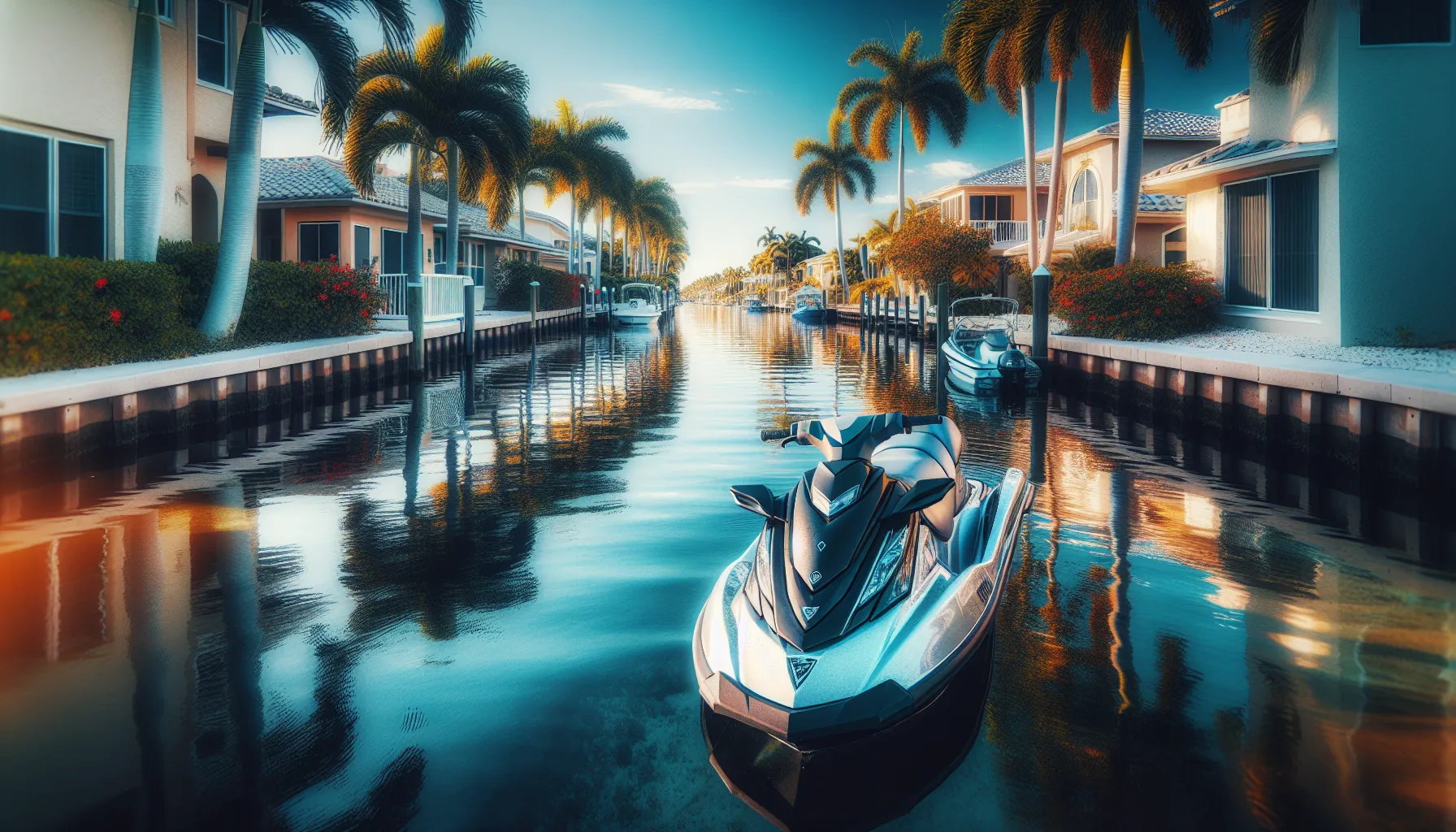
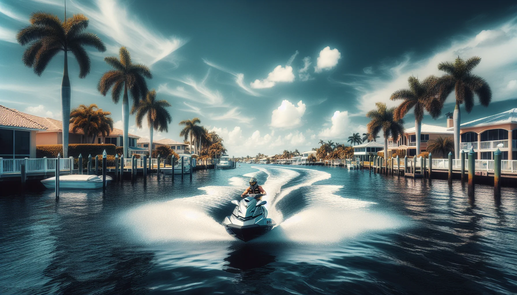
Most of Cape Coral's canals are not open waterways - they are the backyards of tens of thousands of waterfront homes. That single fact drives almost every rule and hazard you will encounter. The channels are narrow, lined with seawalls that create blind 90-degree corners, and crowded with docked boats, kayakers, and swimmers. A wake that would be harmless in open water can slam a moored vessel against a piling or erode a neighbor's seawall here.
The system also mixes two water types that never connect freely: brackish, tidal, Gulf-access canals and enclosed freshwater canals held back by locks and weirs. Ride into the wrong branch and you can travel for miles only to hit a wall of concrete with no way through. Add tidal current near the river, seasonal manatee closures, and GPS signal that drops behind tall homes, and you have an environment that rewards planning and punishes improvisation.
The good news: with a paper or offline canal map, a full tank, and an understanding of the categories below, Cape Coral becomes one of the most rewarding rides in Southwest Florida. If you are still choosing a machine, our companion guide to jet ski rentals in Cape Coral covers where to launch and what to look for in a rental.
Gulf-Access vs. Freshwater Canals: Know Before You Go
The first skill every Cape Coral rider needs is telling the two canal families apart, because only one of them takes you anywhere.
Gulf-Access Canals
These connect - directly or through a single lock - to the Caloosahatchee River and, from there, to San Carlos Bay, Pine Island Sound, and the open Gulf. They tend to run deeper, carry more boat traffic, and border the city's higher-value waterfront. "Direct" or "sailboat" access canals reach the river with no bridges or locks in the way; "lock-access" canals reach it through one of the city's navigation locks. If your goal is the river or the Gulf, you want to start and stay in this family.
Freshwater (Landlocked) Canals
These form enclosed basins that hold fresh water for the neighborhoods around them. They are separated from the tidal system by locks and weirs specifically so that saltwater does not intrude and freshwater does not drain out. They are quieter and calmer - pleasant for a slow cruise or getting comfortable on a new machine - but they do not lead to the river, and many terminate abruptly.
How to Tell Them Apart Before You Commit
- Study a canal map first. Cape Coral's own maps and marine chart apps such as Navionics label access types. Do this on land, not mid-ride.
- Watch for lock and weir structures. A lock ahead means you are leaving or entering the freshwater system.
- Note the water and traffic. Deeper channels with steady powerboat traffic usually signal Gulf access; still, shallow, empty branches often signal a freshwater dead end.
- Ask locally. Marina staff and dock neighbors know the shortcuts and the traps better than any app.
Reading the Route: Major Waterways and Where They Lead
Rather than memorize dozens of individual canals, anchor your navigation to the handful of big waterways every route ties into.
The Caloosahatchee River - Your Main Artery
Nearly every trip out of Cape Coral funnels to the Caloosahatchee River along the city's southern and eastern edge. Head downstream (west) and you reach the Sanibel Causeway and San Carlos Bay; head upstream (east) toward Fort Myers. The river is well marked, but it carries real tidal current and boat traffic, so treat it as open water: keep a proper lookout, cross channels at right angles, and give larger vessels room.
Toward Sanibel and San Carlos Bay
From central Cape Coral - the Yacht Club and Bimini Basin area - riders reach the river and run downstream past the Sanibel Causeway into San Carlos Bay, where dolphin sightings are common and the water opens up. This is a longer, more exposed run; treat it as a planned trip with fuel and weather checks, not a spur-of-the-moment detour.
North Toward Matlacha Pass and Charlotte Harbor
The northwest reaches of the city connect toward Matlacha Pass and, beyond it, the wide expanse of Charlotte Harbor. These waters are shallow in many places, thin on fuel stops, and exposed to wind and afternoon storms - genuinely advanced territory for a personal watercraft. If you are heading that far north, the neighboring jet ski rentals in Punta Gorda guide covers the Charlotte Harbor side and its own hazards.
A universal rule for every route: plan your return before you leave. A jet ski that is comfortable outbound with a fresh tank and a favorable tide can be a long, thirsty slog home against wind and current. Turn around with fuel and daylight to spare.
Bridges, Clearances, and the Cape Coral Bridge
Bridges shape where a jet ski can and cannot go, and they fall into two types.
Fixed Bridges
Fixed spans have a set vertical clearance that does not change - but the water beneath them does. At high tide, clearance shrinks; at low tide, it grows. For a low-profile jet ski, most residential and roadway fixed bridges are not a height problem, but they are almost always no-wake or idle-speed zones, and their shadows hide oncoming traffic. Approach near the center of the channel, keep your speed down, and look through the opening before you commit.
The Cape Coral Bridge and Moveable Spans
The Cape Coral Bridge and similar movable structures open for tall vessels on request, typically hailed on VHF or by horn signal, and larger boats may be waiting nearby for an opening. As a jet ski you can usually pass underneath without an opening, but never assume the water around a movable bridge is calm or empty - large vessels stage there, currents funnel through, and no-wake rules apply. Slow down, hold your line, and stay clear of any boat lining up for the span.
Because tide, current, and posted clearances vary bridge to bridge, verify the specific structure on a current chart before you rely on it. When in doubt, idle through and keep your eyes up.
How Locks Work for Jet Skis
Cape Coral operates navigation locks - Chiquita Lock among the best known - that let boats move between the freshwater canals and the tidal, Gulf-access system while keeping the two water bodies separate. Locking through on a jet ski is straightforward once you know the sequence.
Approaching the Lock
- Slow to idle speed well before the structure.
- Watch for a traffic signal or the lock tender's direction.
- Use the call box or button if one is provided, and wait for the go-ahead - a green light or the tender waving you in.
- Do not crowd the gates or force your way in ahead of larger boats.
Inside the Chamber
- Enter slowly and hold your position; jet skis are often rafted in with other small craft.
- Keep hold of a grab line or the chamber wall as directed - Cape Coral's locks equalize only a modest change in water level, but you still want to stay put.
- Keep your engine off or idling exactly as the tender instructs.
- Wait for the far gates to open fully and for the signal before you power up and exit.
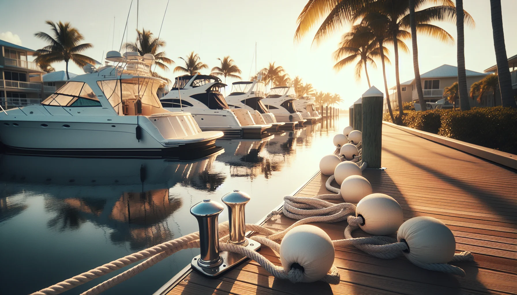
The whole cycle usually takes only a few minutes. Be patient - the lock may hold for additional boats before cycling, and rushing is how fenders get crushed and tempers flare. Courtesy at the lock is part of the same dock-and-marina etiquette covered in our Cape Coral dock etiquette guide.
Idle Speed, Manatee Zones, and Wake Rules
Speed enforcement is the single biggest source of tickets in Cape Coral's canals, and the rules are stricter than newcomers expect.
No Wake Means No Wake
Residential canals are idle-speed and no-wake zones. Idle speed means the slowest speed at which you can still steer - not "a little slow," but genuinely minimal throttle. The reason is physical, not arbitrary: your wake reflects off seawalls, rocks docked boats, and undermines the concrete walls that hold the neighborhood together. Marine officers do patrol these canals and do respond to resident complaints, so ride as if someone is always watching, because often someone is.
Manatee Protection Zones
Southwest Florida is prime manatee habitat, and Cape Coral's waterways include posted manatee protection zones - some year-round, some seasonal, typically tightening through the cooler months when manatees gather in warmer water. In these zones you must hold to the posted speed, which is usually idle or slow. Beyond the legal requirement, a collision with a manatee is often fatal to the animal, so scan for the tell-tale swirl ("footprint") on the surface and the rounded back or snout. Our statewide breakdown of Florida manatee zones and speed regulations explains how to read the signs and when seasonal zones apply.
Operating Hours
Under Florida law, a personal watercraft may not be operated from a half-hour after sunset to a half-hour before sunrise - PWC are a daytime-only vessel statewide, and that applies fully in Cape Coral. Plan your loop so you are off the water well before dusk.
Avoiding Dead Ends and Getting Lost
The maze that makes Cape Coral fun is also what strands unprepared riders. A few habits keep you out of trouble.
Where People Get Trapped
- Freshwater branches that "look" navigable but terminate at a lock, weir, or seawall with no through passage.
- Newer or partially built neighborhoods where canals were dredged but never connected, leaving abrupt ends.
- Lookalike intersections deep in the grid, where one wrong turn puts you into a basin with a single way out.
Practical Ways to Stay Oriented
- Map before you launch. Download offline charts (cell and GPS signal both weaken between tall homes) and mark your turnaround points, fuel stops, and the canals that actually reach the river.
- Drop breadcrumbs. Use a marine app that records your track so you can retrace your exact path out.
- Learn the area in layers. Start with one Gulf-access route, get it wired, then expand. Do not try to explore the whole 400 miles in a single afternoon.
- When confused, stop and assess. Idle, check your track, and follow the wider, busier channels - they trend toward the river and the way out. Flag down another boater if you need a bearing.
Reading the marks correctly is a core skill everywhere in Florida, not just here; our guide to Florida channel markers and navigation aids explains the buoy and marker system you will rely on the moment you leave the canals for the river.
Fuel, Range, and Trip Planning
Jet skis have small tanks and drink fuel fast, and canal riding makes it worse: constant idling, no-wake crawling, and stop-and-go maneuvering all burn more per mile than a steady cruise. Running dry a few miles deep in the grid is a genuinely bad afternoon.
- Launch on a full tank, every time. Do not start a canal exploration at three-quarters.
- Know your fuel stops before you go. Public marinas around the Yacht Club, south Cape, and Cape Harbour areas offer on-water fuel; note their locations and hours on your map rather than hoping to find one mid-ride.
- Keep a reserve. A common rule of thumb is one-third out, one-third back, one-third in reserve. Idle zones and headwinds eat into that fast, so err conservative.
- Pad your time estimates. Add a healthy margin to any app's route time to account for no-wake stretches, lock cycles, bridge waits, and traffic. What looks like a 30-minute hop can easily double.
Carry a charged phone in a waterproof case, tell someone your route and return time, and check the forecast - Southwest Florida's summer afternoons produce fast-building thunderstorms that you do not want to meet miles from the ramp.
Legal Requirements Every Cape Coral Rider Must Meet
Before the fun comes the law, and Florida's requirements are non-negotiable on Cape Coral's water.
Boater Education
Anyone born on or after January 1, 1988 must carry a Florida Boating Safety Education Identification Card to operate a vessel of 10 horsepower or more - and every modern jet ski clears that bar easily. The card is earned by completing an approved course and passing the exam; you carry it, along with a photo ID, whenever you ride. You can get your Florida boating license online through a state-standards online, NASBLA-recognized course and finish at your own pace.
Age and Operating Rules for PWC
- Minimum operating age for a PWC is 14 in Florida, and operators in the covered age range must also have the education card. Our full breakdown of Florida jet ski and PWC laws and age requirements walks through the details for teens and parents.
- The engine cut-off lanyard must be attached to you (wrist or PFD) whenever you are underway, so the machine stops if you come off.
- PWC are daytime-only - no operation from a half-hour after sunset to a half-hour before sunrise.
Safety Gear and Sober Operation
Every person aboard a PWC must wear a proper Coast Guard-approved life jacket - this is stricter than for many other vessels, where PFDs need only be aboard and accessible. Boating under the influence is enforced on the water exactly as impaired driving is on the road: the limit is a 0.08 BAC (0.02 if you are under 21). Finally, know the accident-reporting duty: you must report a boating accident that involves death, a disappearance, injury beyond simple first aid, or roughly two thousand dollars or more in property damage.
The course covers all of this and more, and the exam is only 25 questions with an 80% passing score and unlimited retakes - so there is no reason to ride unlicensed.
Start the state-standards online course - $12.99
Conclusion
Cape Coral's canal system is a rare kind of playground - hundreds of miles of connected water, wildlife around nearly every corner, and a clear run to the Gulf for those who know the way through. But it is first and foremost a residential neighborhood built on water, and it rewards riders who prepare: know your Gulf-access canals from your freshwater dead ends, respect every no-wake and manatee zone, lock through patiently, plan your fuel and your return, and carry the credentials Florida requires. Learn the area a route at a time, ride courteously, and these waterways will stay open and welcoming for everyone who follows.
The single best first step is getting legal and educated. A few hours in an approved course will teach you the navigation, right-of-way, and environmental rules that keep Cape Coral's canals safe - and hand you the card the law requires.